40% OFF & Free Shipping Worldwide with Code APRIL40


Think About Maps
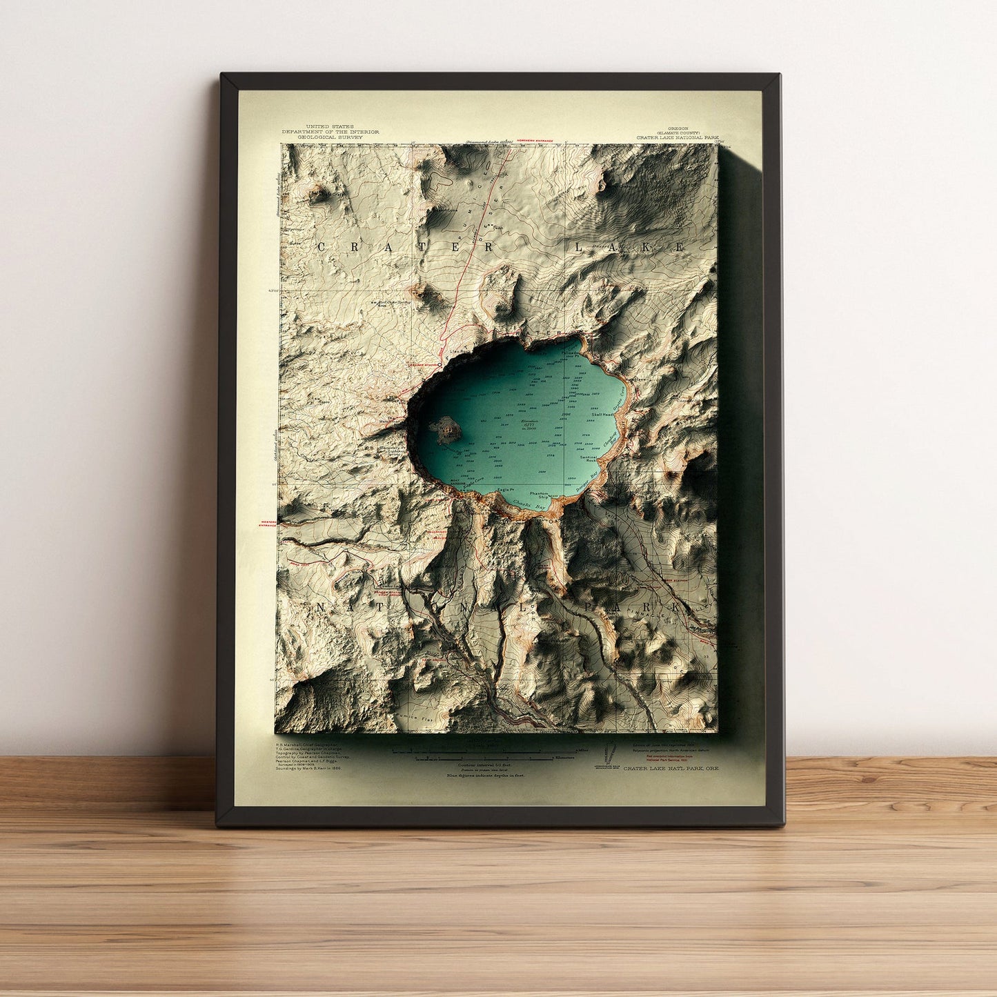
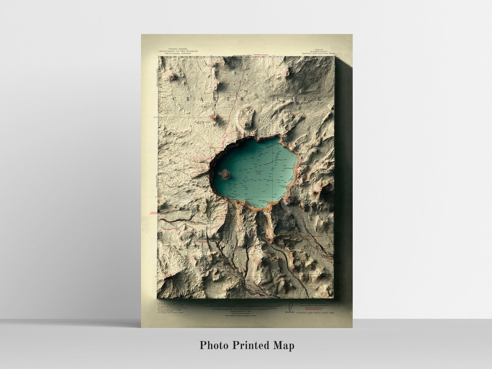
Crater Lake, Oregon 2D Relief Map (1911) - Option 2 Foggy Night
Crater Lake, Oregon 2D Relief Map (1911) - Option 2 Foggy Night
Couldn't load pickup availability
1911 Shaded Relief Map of Crater Lake, Oregon, USA - 2D Flat Print
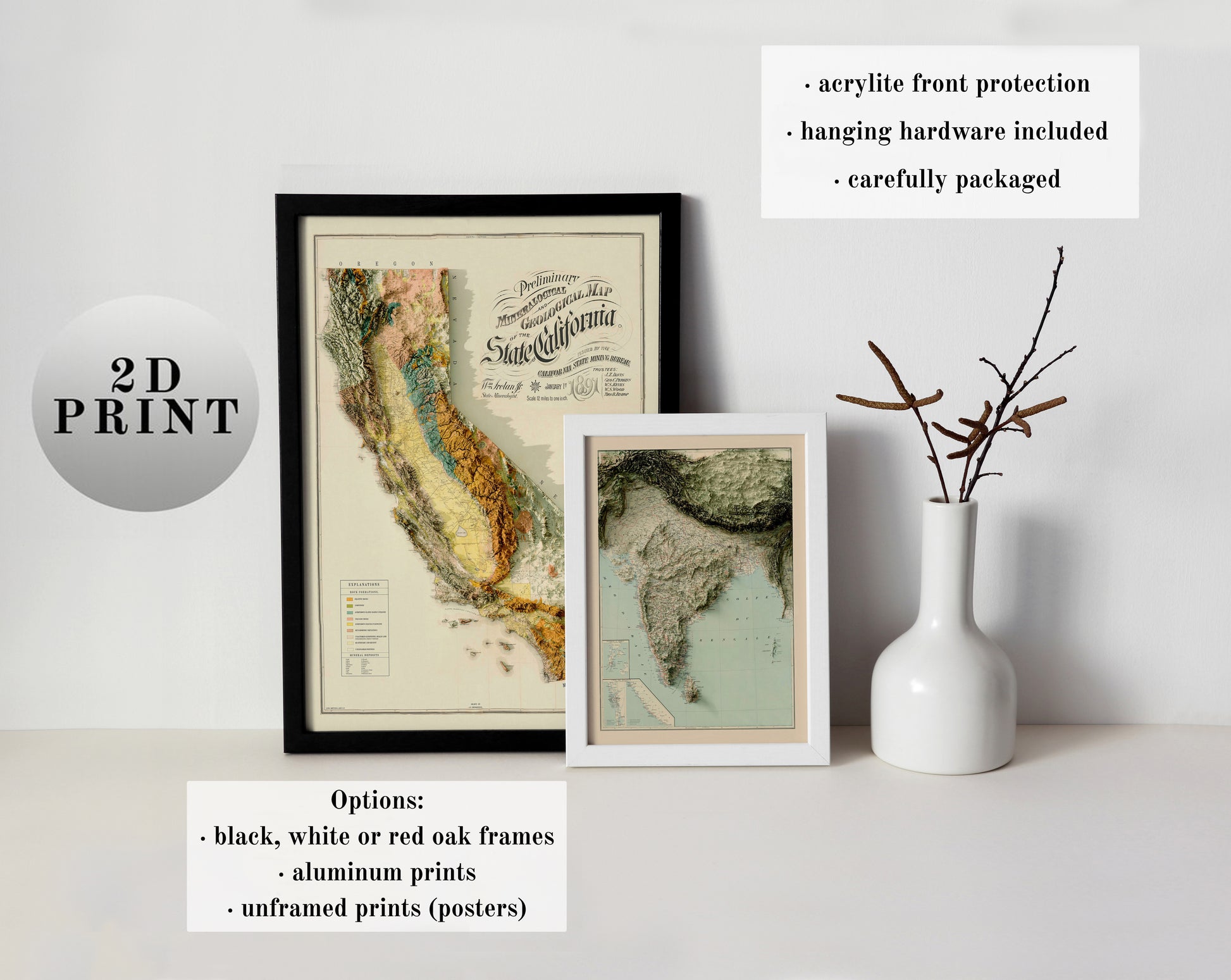
These are NOT 3D maps. They are printed on a flat paper. You cannot touch or feel any relief, not even if you buy a framed map. There is NO guarantee that captions and labels will be legible. You may not be able to read the text on the map. These are DECORATIVE maps, NOT for study, reference, or close-ups.
ABOUT THE MAP
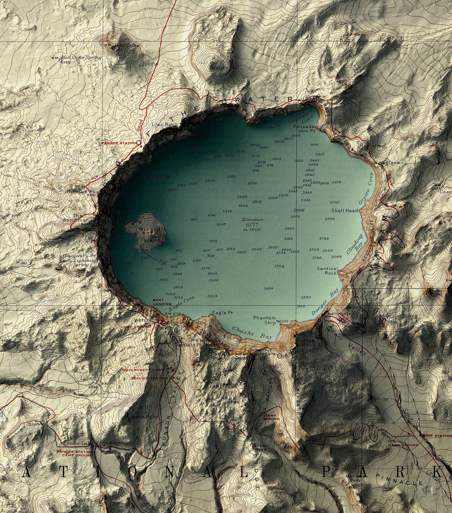
This is a 1911 historical Map of Crater Lake, Oregon, that has been restored and blended with a modern relief map created with satellite elevation data. The maps are digitally rendered (2D prints), which gives them a new life in a vintage and contemporary manner. The relief is obtained from the Shuttle Radar Topography Mission (SRTM). We focus on every detail of production, and all our products are carefully designed and packaged to enrich your home. Our maps are also great gifts.
You can read more and about how we create these maps HERE
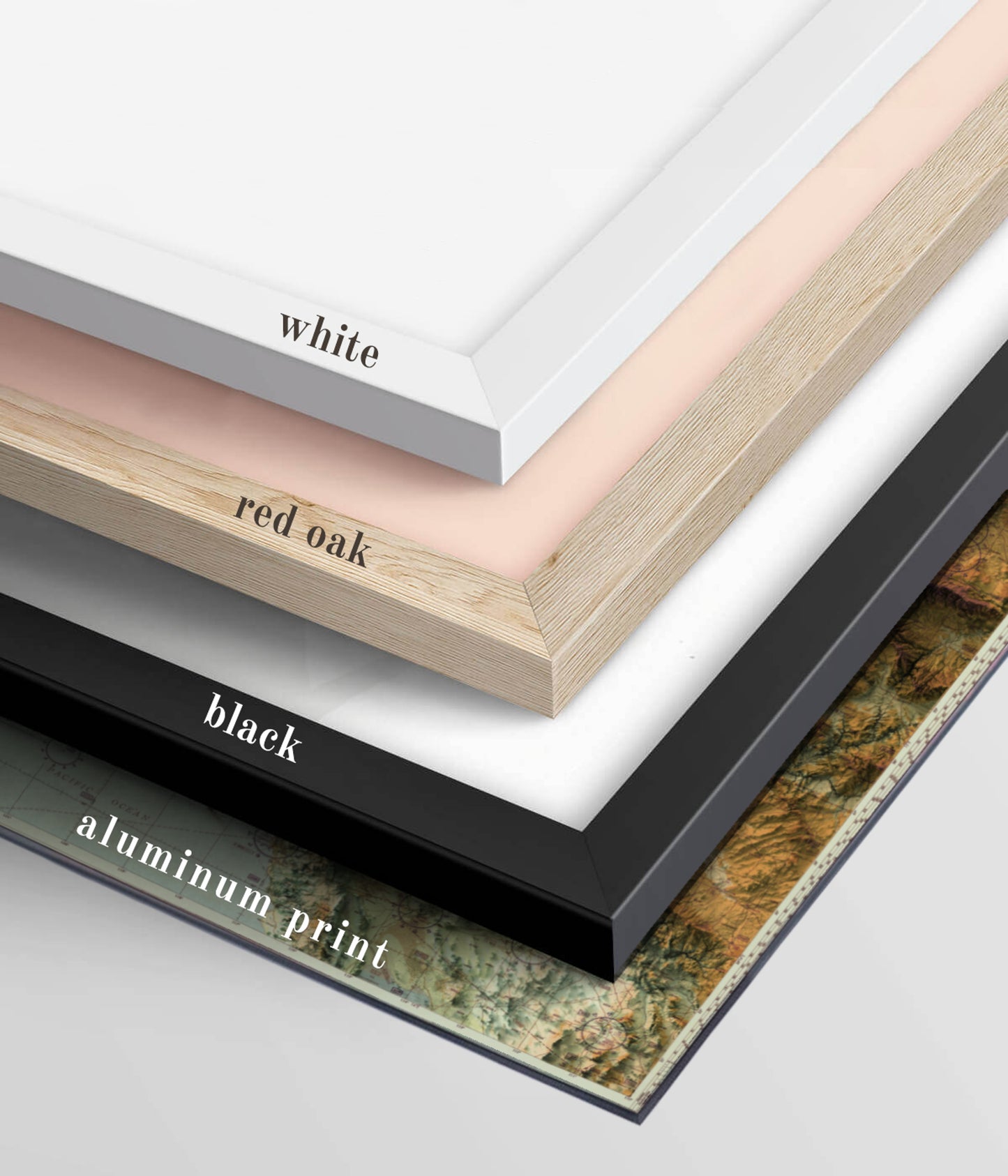
FRAMES AND PAPER
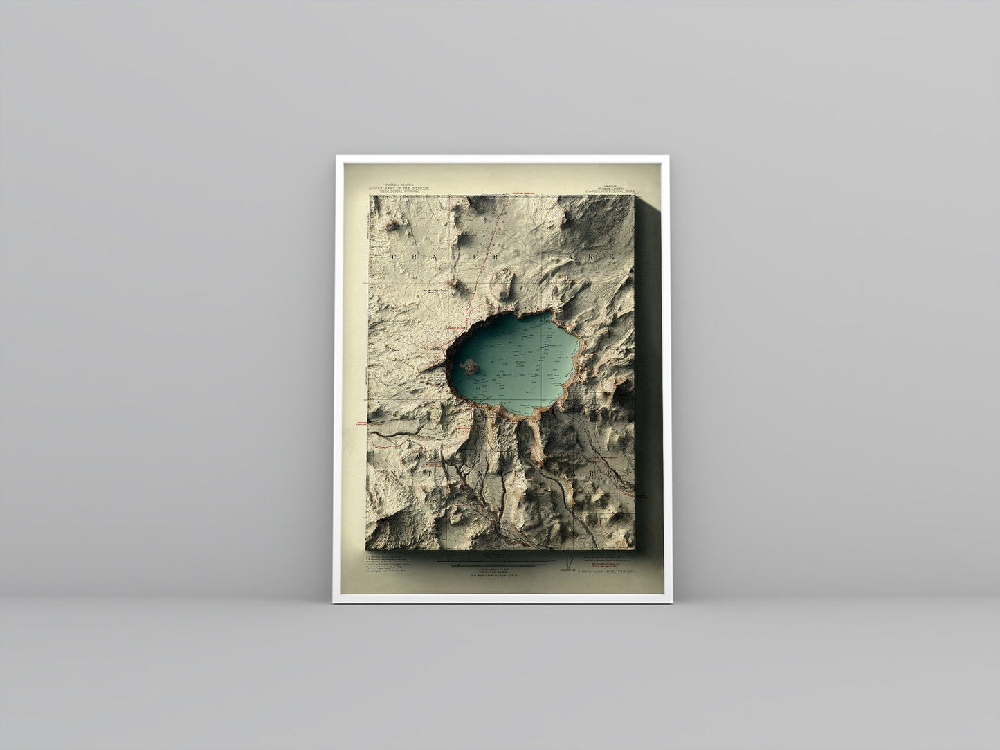
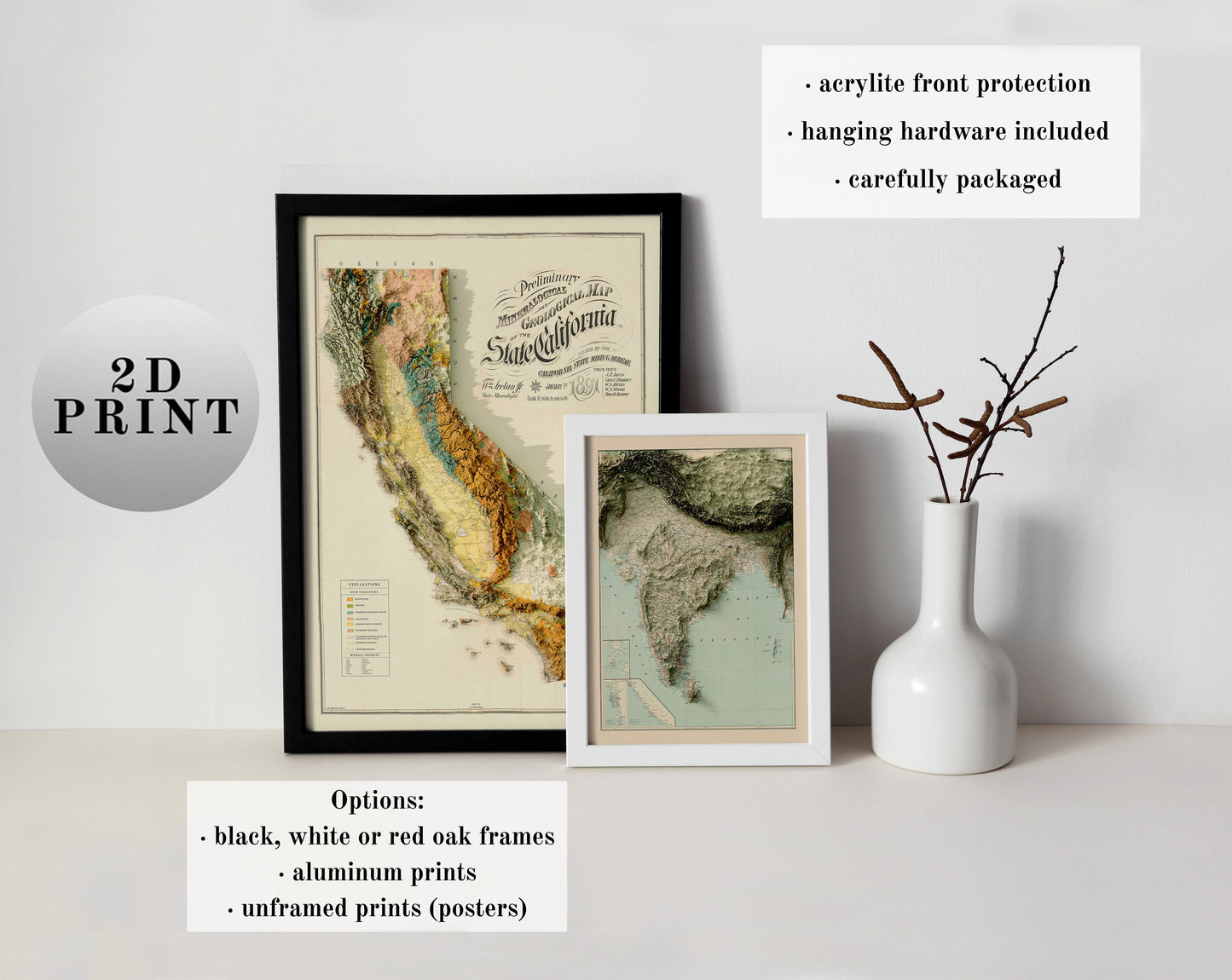
There are three options available: unframed posters (frames are not included), framed maps (black, white, and red oak frames), and aluminum prints.
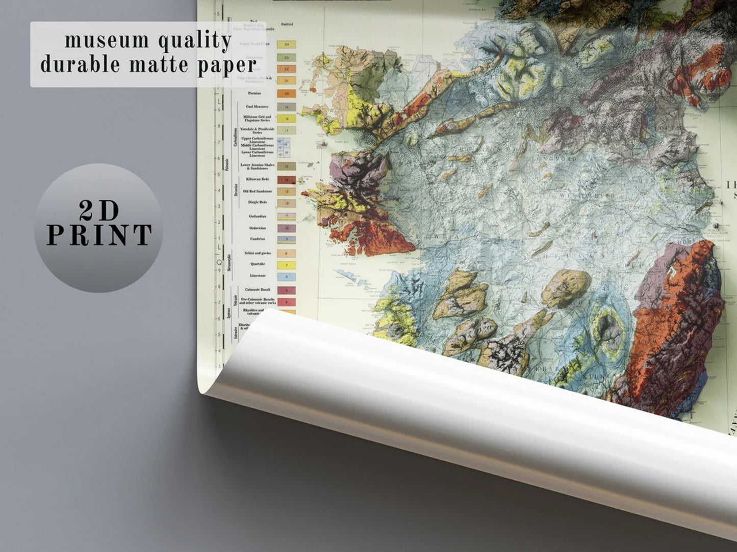
UNFRAMED MAPS:
A museum-quality poster printed on thick and durable matte paper. Add a wonderful map to your room and office with this poster that will surely brighten any wall. Frames are not included in this option.
• Paper thickness: 10.3 mil
• Paper weight: 5.6 oz/y² (192 g/m²)
• Giclée printing quality
• ISO brightness: 104%
• Unframed maps are shipped in tubes.
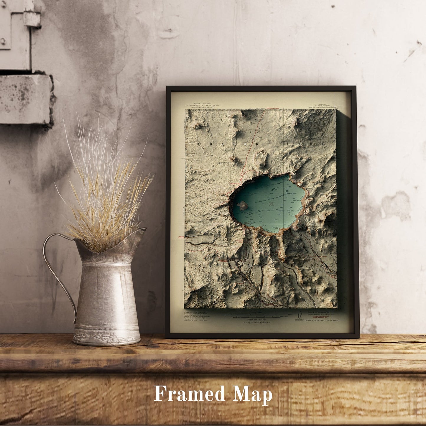
FRAMED MAPS:
A framed map with museum-quality matte paper that will add a refined touch to your home decor. It comes pre-framed and ready to adorn any room you wish.
• Semi-hardwood frame made from renewable forests
• 0.75” thick frame
• Acrylite plexiglass front protector
• Lightweight
• Hanging hardware included
• Frames available in black, white, and red oak options.
ALUMINUM PRINTS:
Visually striking, polished, and built to last. Our stylish aluminum prints are designed with superior quality and a clean finish. Frames are not necessary and not included.
• Premium 3mm Dibond aluminum material that ensures high durability and scratch resistance for years.
• Hanging kit and instruction included.
• The print itself is matte and glare-free, giving it a timeless and classic look.
FULFILLMENT AND SHIPPING
Free shipping worldwide!
- How long does fulfillment take? 2-5 business days from January to October and 2-10 in November and December.
- What is the estimated delivery time? 2-21 business days after fulfillment, depending on the destination country:
USA: 2-7 days.
Europe and Canada: 3-14 days.
Other countries: 3-21 days (occasionally a few more days).
Read more about refunds and returns HERE
Let me know if you have any questions. Thank you very much!
How we make these maps
How we make these maps
We are really glad to see that you are interested in our maps! We create maps because we love geography and art. With this brief text, we aim to explain how we create these maps.
These are old maps that have been restored and merged with modern relief maps created using satellite elevation data (printed in 2D – the maps are flat to the touch), displaying the relief of places in a vintage and contemporary manner, giving them a new perspective.
The relief data is obtained from the Shuttle Radar Topography Mission (SRTM), and we use some software and techniques to make the maps look like they have real relief. Some maps are not based on old maps; they are just stylized to appear antique or modern. Other maps, such as those of the moon, planets, and world maps, can also undergo this process. All the other maps are based on old maps.
Creating these maps is not an easy task. To summarize, the process can be seen in the images below:


SHOP ALL MAPS HERE
Shipping & Holidays Deadlines
Shipping & Holidays Deadlines
How long does fulfillment take? 2-5 business days from January to October and 2-10 in November and December. What is the estimated delivery time? 3-21 business days after fulfillment, depending on the destination country.
USA: 2-7 days.
Canada: 2-10 days.
Europe: 3-14 days.
Other countries: 3-21 days (occasionally a few more days).
Holidays deadlines:
THERE IS NO GUARANTEE that you will receive your map before the
Holidays (Thanksgiving and Christmas). We do our best, but once packages
are in the hands of the carriers, it depends on their capacity.
Place your order before the dates below for a better chance of receiving it before the Holidays.
USA: Thanksgiving – November 12. Christmas – December 12.
Europe and Canada: Thanksgiving – November 3. Christmas – December 3.
Other countries: Thanksgiving – November 1. Christmas – December 1.
Carriers
Carriers vary by country. In the US, we usually ship by FedEx, USPS, UPS or DHL. Other countries: FedEx, DHL, DPD, Latvian Postal Services, Correos España, Correios Brasil, Royal Mail UK, Asendia, Canada Post and some other carriers, depending on the destination country.
Refunds and returns
Refunds and returns
Refund policy
We are dedicated to offering high-quality products. Due to
the exclusive nature of our maps, all of them are printed on demand. Our goal is to ensure your complete satisfaction with our products. If for any reason you are not entirely happy with your purchase, we offer a return period of 14 days from the date of receipt. To be eligible for a return, the item must be unused, in the same condition that you received it, and in its original packaging. Please contact us within this 14-day period to initiate the return process.
Wrong or Damaged Prints
Sometimes, we use the services of a specialized company to print and send out the maps, depending on where you live. This makes the process faster. Considering this, I cannot inspect all maps before they are sent. Please let me know if you have any problems with your map. If you receive your map and it is damaged, please send us a message with some photographs, and we will either send you a replacement map or refund your money.
Lost packages
If your map has not been delivered after the estimated delivery date, please send us a message and we will attempt to resolve the issue by contacting the carriers. Should the package be confirmed as lost, we will ship another product
Incorrect address
We are not responsible for packages that are lost due to an incorrect address or delivered to the wrong location. Please ensure that you check your information, address, and postal code carefully before placing your order to avoid potential issues.
Returns
Before returning a map, please send us an email at info@thinkaboutmaps.com, and we will provide you with instructions.